School Traffic Management Plan
Find out how to travel safely to Chua Chu Kang Secondary School and follow the traffic rules that keep everyone safe.
School Traffic Management Plan
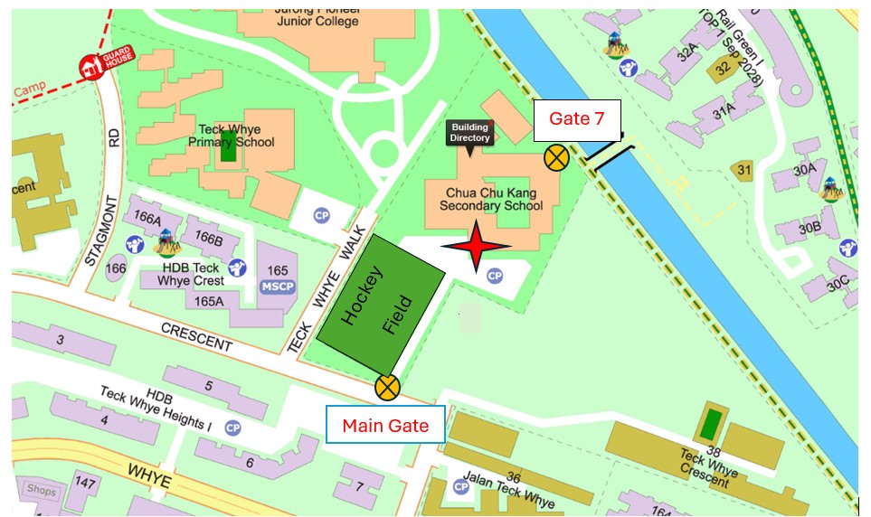
Chua Chu Kang Secondary School is located at 31 Teck Whye Crescent, Singapore 688848. Due to the proximity of Teck Whye Primary School (TWPS) and Jurong Pioneer Junior College (JPJC), morning traffic can be heavy.
Aim
Our traffic management plan ensures the safety of students, staff, and visitors while minimizing congestion and promoting orderly traffic flow within school premises.
Key Considerations
Ensure safe usage of school roads
Facilitate safe entry and exit for pedestrians and vehicles
Minimize traffic congestion and ensure smooth flow
School’s Operating Hours
For Pedestrians and Cyclists
Main Entrance: 6:30 AM - 6:00 PM (Mon-Fri)
Side Gate 7 (Pang Sua Park Connector): 7:00 AM - 8:00 AM (Mon-Fri)
For Vehicles
Main Entrance (except Saturdays, Sundays, and public holidays)
Peak Hours: 6:30 AM - 8:00 AM (Mon-Fri) - OPEN (Barrier UP)
Off-Peak Hours: 8:00 AM - 6:00 PM (Mon-Fri) - OPEN (Barrier DOWN)
Transportation to School
Public Transport
Buses: 190, 975, 985, 982E and 984 (4-6 mins walk from nearest bus stop)
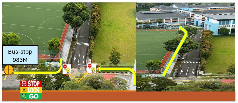
Bus 983M: School term weekdays only, arrives at the school at 6:59 AM, 7:09 AM and 7:19 AM respectively
MRT:
Choa Chu Kang Station (NS4) - 21 mins walk
Bukit Panjang Station (DT1) – 18 mins walk
LRT: Phoenix Station (BP5) - 11 mins walk
By Car
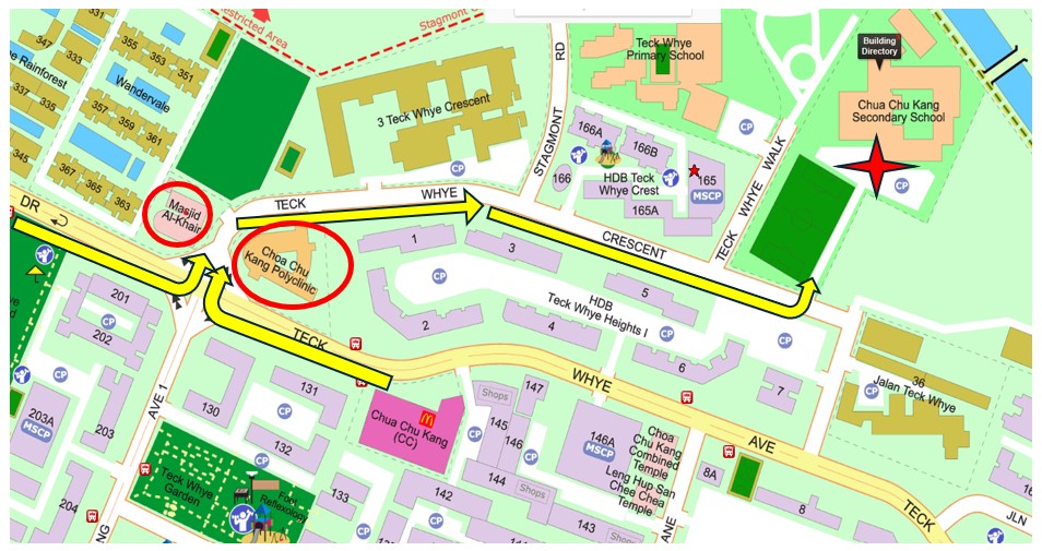
Enter Teck Whye Crescent via Masjid Al-Khair Mosque and Choa Chu Kang Polyclinic to avoid congestion.
Cycling
Register bicycles at the general office with parental consent
Use proper safety equipment
Dismount before entering school compound
Adhere to safety rules to avoid cycling ban
Safety Measures
For Pedestrians/Cyclists
Use traffic lights at Teck Whye Walk and Teck Whye Crescent junction
Follow road marshals' signals at the main entrance
Use zebra crossings within school compound
Cyclists must dismount and push bicycles when entering
For Vehicles (6:30 AM - 8:00 AM)
Enter via Teck Whye Crescent (Masjid Al-Khair Mosque/CCK Polyclinic route)
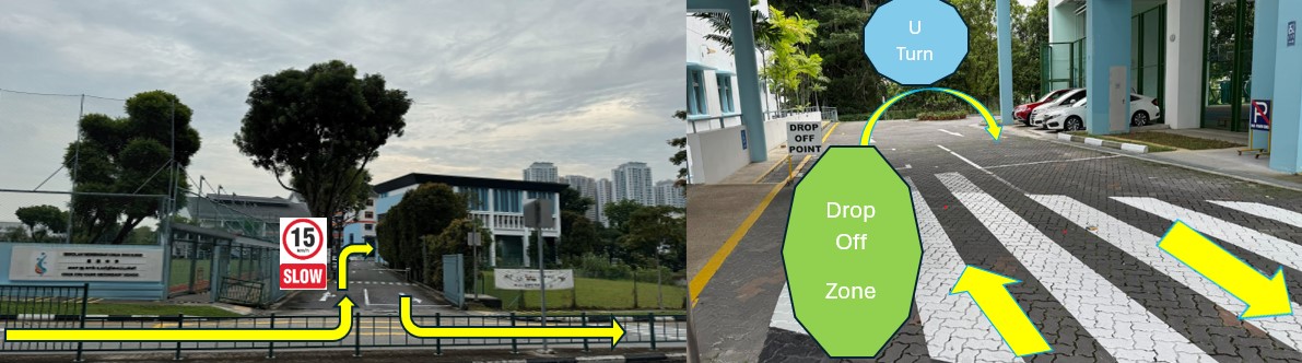
Observe 15km/hr speed limit within school
Use designated drop-off zone at school porch
Exit via roundabout at main entrance